Mozambique on the east coast of Africa is one of our homeschool countries-of-the-week, so why not spend a few minutes today with your students learning about one of Mozambique’s World Heritage Sites: the Island of Mozambique.
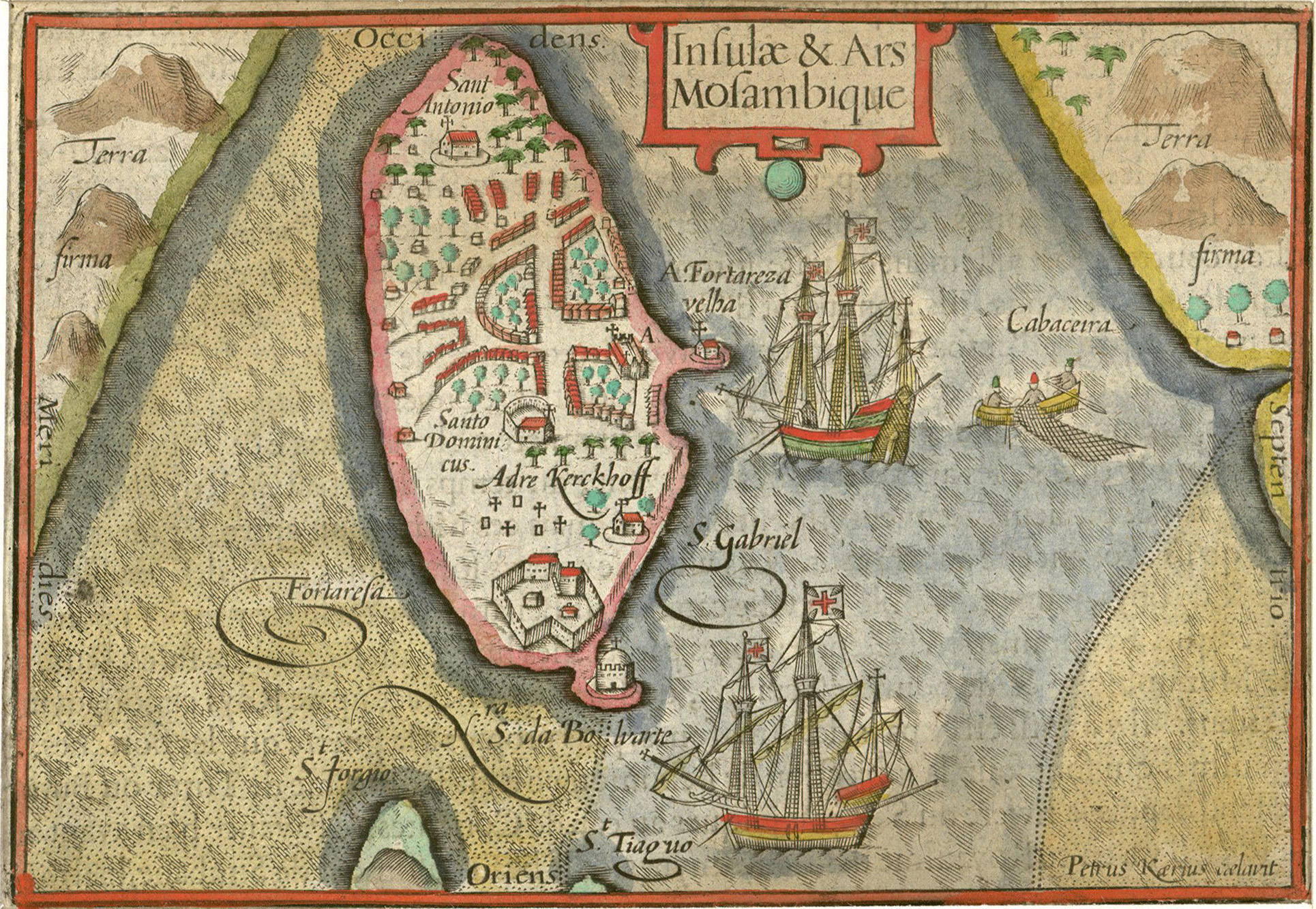
The Island of Mozambique was the colonial capital of Portuguese East Africa for nearly 400 years and a focal point of trade throughout the Indian Ocean:
The Island of Mozambique is a calcareous coral reef situated 4 km from the mainland coast in the entrance to the Mossuril Bay of the Indian Ocean in Nampula Province of the Republic of Mozambique. A bridge built in the 1960s joins the island to the mainland. The island forms an archipelago with two small uninhabited islands, the Islands of Goa and Sena to the east.
The island communities are intimately associated with the history of navigation in the Indian Ocean as the island played a unique role in intercontinental trading links from the 10th century. Its international historic importance relates to the development and establishment of Portuguese maritime routes between Western Europe and the Indian subcontinent.
The Island of Mozambique has two different types of dwellings and urban systems. The stone and lime town of Swahili, Arab, and European influences in the north half, and the macuti town (city of roofed palm leaves) of traditional African architecture in the south. The stone and lime town, with its administrative and commercial properties, was the first seat of the Portuguese colonial government that lasted from 1507 to 1898. Thereafter the capital was transferred to Lourenço Marques (now Maputo). The urban fabric and fortifications of Mozambique Island are exceptional examples of architecture and building techniques resulting from cultural diversity, and the interaction of people of Bantu, Swahili, Arab, Persian, Indian, and European origin. (World Heritage Centre #599)
The opening of the Suez Canal in 1869, which allowed direct travel from the Mediterranean to the Indian Ocean without having to round the Cape of Good Hope, led to a decline in the island’s commercial importance in the late nineteenth century.

You can find a gallery of additional photos of the Island of Mozambique on the World Heritage Centre’s website.
World Heritage Sites are cultural or natural landmarks of international significance, selected by their home countries and recognized by the United Nations Educational, Scientific, and Cultural Organization. More than a thousand such sites have been designated in over 160 countries, and we feature one every Wednesday, drawn from one of our homeschool countries-of-the-week. You can find a complete list of World Heritage Sites online at the World Heritage Centre’s website and in Wikipedia.
The World Heritage Centre also has a free and comprehensive World Heritage education kit for teachers, as well as a wonderful full-color wall map of World Heritage Sites, available for the cost of shipping. Why not add them both to your own homeschool library. 🗺
What world treasures are you and your students exploring in your homeschool this Leo Term? 🇲🇿
❡ The great globe itself: This is one of our regular Homeschool Geography posts featuring cultural and natural sites of international importance. Print your own copy of our River Houses World Heritage Calendar and follow along with us as we tour the planet, and add your name to our weekly mailing list to get great homeschool teaching ideas delivered right to your mailbox all through the year. 🌐
❡ Print this little lesson: Down at the bottom of this post you'll find a special "Print" button that will let you create a neat and easy-to-read copy of this little lesson, and it will even let you edit and delete sections you don't want or need (such as individual images or footnotes). Give it a try today! 🖨
❡ Books in the running brooks: You can always turn to your River Houses almanac, atlas, and history encyclopedia for more information about any of our countries-of-the-week. The almanac has a lengthy section with detailed profiles of all the nations of the world; the endpapers of the atlas are indexes that will show you where all of the individual national and regional maps may be found; the history encyclopedia has a comprehensive collection of national histories in an appendix; and you can find additional illustrations, flags, and other mentions through the indexes in each of these volumes. For an ideal little lesson, just write the name of the Weekly World Heritage Site on your homeschool bulletin board, find its location in your atlas, read the WHC's brief description aloud, look at a picture or two, and you're done. Over the course of the year, without even realizing it, your students will absorb a wealth of new historical, geographical, and cultural information. 📚
❡ Homeschool calendars: We have a whole collection of free, printable, educational homeschool calendars and planners available on our main River Houses calendar page. They will help you create a light and easy structure for your homeschool year. Give them a try today! 🗓
❡ Support our work: If you enjoy our educational materials, please support us by starting your regular Amazon shopping from our very own homeschool teaching supplies page. When you click through from our page, any purchase you make earns us a small commission at no extra cost to you. Thank you for helping us to keep going and growing! 🛒
❡ Join us! The aim of the River Houses project is to create a network of friendly local homeschool support groups — local chapters that we call “Houses.” Our first at-large chapter, Headwaters House, is now forming and is open to homeschoolers everywhere. Find out how to become one of our founding members on the Headwaters House membership page. 🏡

